Ifraagasaetterskan
Lena Synnerholm's blog.
On maps and navigation
Flat-earthers use to claim the world looks like this:
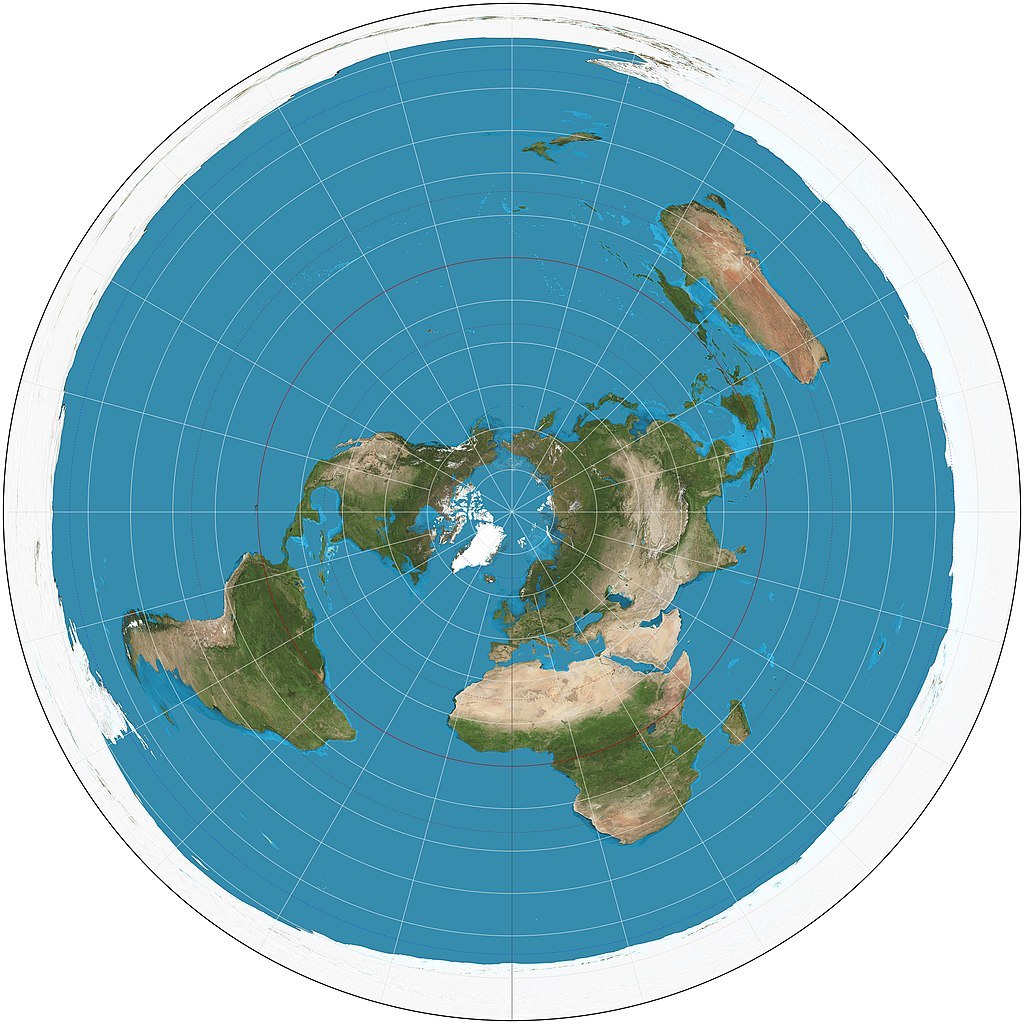
This map is made by Daniel Strebe.
Landmasses lying south of the equator gets an entirely different shape than on an Earth globe. If they really had that shape and not the ones they have on the Earth globe people would have noticed it. Everyone is not that clueless about how analogue map and compass are used. If the shape in the east-west direction did not match at all this would have been quickly revealed. It would have been particularly clear to Chileans which live in the world’s most elongated country. However, Australians would have noticed this too.
Flat-earthers may then claim the world looks like this:
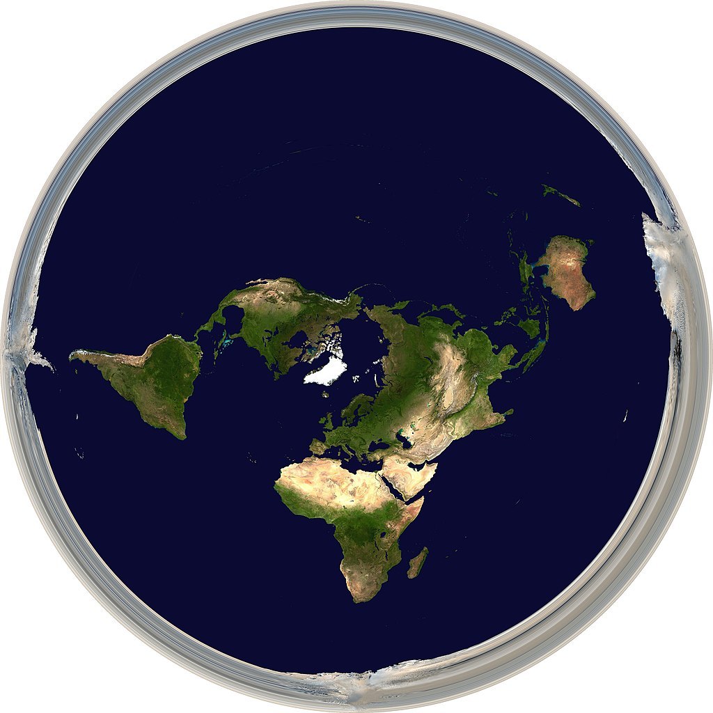
This map is made by Hellerick.
This solves the problem with the landmasses but worsen the problem for the seas. Single individuals and small groups can get across the seas in yachts. If the seas were so much larger, they would have discovered it. Moreover, they would have been forced to turn in one direction much more often than turn in the other one. This too they would have noticed.
During the last few centuries millions of ships have crossed the oceans. Of cause navigators had problems telling where they were when new areas were explored. However, when the routs were well established this was not such a large problem anymore. Then the navigations methods have improved over the course of centuries. One can use the same methods which were used in the middle of the 20th century. Then one can find the way across the oceans without any larger problems.
Current sea transports are based on things arriving on time. As such one has to know how long sea transports take. Fruit and vegetables keeping fresh for some time still have limited keeping qualities. It also happens that live animals are transported in containers by sea. They are then provided with enough food and water for a calculated traveling time. Even when such are not critical things are expected to arrive on time. On the 23rd of Mars 2021 the gigantic ship Ever Given got stuck sideways in the Suez Canal. For six days it blocked the canal before people got the ship off. This caused trouble for world trade which was reported at the time. Such things can’t just be whisked away.
In addition, there are airliners flying long distances over the oceans. Different models of airliners can fly different distances on one refuelling. In contrast there are no larger differences in how fast different models fly. Anyone can buy an air ticket and check for oneself how long it takes. There are non-stop flying routs between cities lying south of the southern tropic on the different continents. These flying routs go from Africa to Australia, from Australia to South America and from South America to Africa. Some flat-earthers deny there are any such flying routs! As if the airlines would be able to hide offering something which does not exist. Dissatisfied customers would have revealed it.
All in all, official maps can’t be as misleading as claimed. They are not only used for education but first and foremost for finding one’s way. Just because one does not know about something it is not a mystery to everyone. People routinely transport themselves and the goods they transport all over the world. This would not have been possible if the maps were so misleading.
Uploaded on the 19th of October 2023.
Commercial rights reserved by Lena Synnerholm if nothing else is stated.
This site was last changed on the 8th of July 2026.